


Giro dell’Orsiera Trekking
The Giro dell’Orsiera (G.O.) is a stunning 6-day loop trekking route set within the Orsiera Rocciavrè Natural Park, just a short distance from Turin in the Cottian Alps. This well-marked, 55 km hiking itinerary is ideal for trained hikers and is supported by an efficient network of 5 mountain huts for overnight stays: Rifugio Balma (1,986 m), Rifugio Selleries (2,035 m), Rifugio Toesca (1,711 m), Rifugio Amprimo (1,375 m), and Rifugio GEAT Val Gravio (1,376 m).
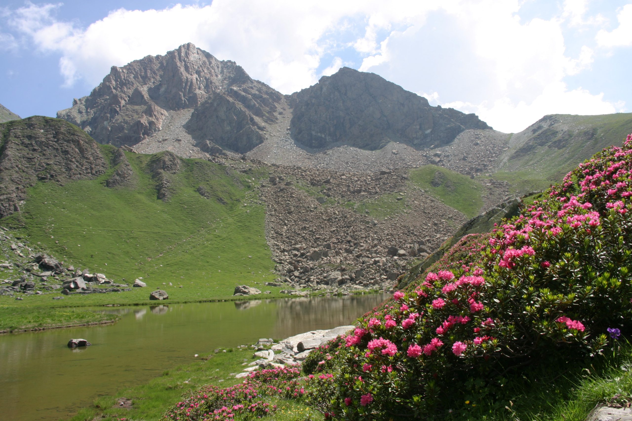
The full circuit starts and finishes in Borgata Molè (Coazze, Val Sangone), but its versatile layout allows hikers to start from any stage or complete shorter sections thanks to connecting valley trails. Crossing alpine pastures, scree slopes, larch forests, and striking glacial lakes, the route offers great opportunities to spot native wildlife (chamois, ibex, golden eagles) and taste traditional local cheeses at high-altitude dairy farms.
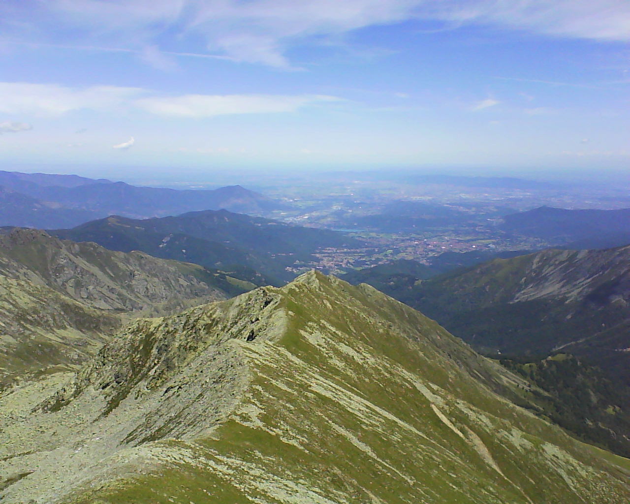
The trail seamlessly weaves nature with rich history and local culture: along the way, you will encounter medieval heritage such as the Certosa di Montebenedetto abbey, ancient rock carvings, cobblestone mule tracks, and historic mountain hamlets. From the highest viewpoints, sweeping panoramas stretch from Monviso to the Po Valley, all the way to Mount Rocciamelone and the French peaks of the Écrins and Vanoise ranges. (An updated hiking map is strongly recommended).
→ For detailed trail information, maps, and official contacts from the Park Authority, visit the official Giro dell’Orsiera guide on the Cottian Alps Protected Areas Authority website.
- timer3 h
- trending_up+899 m
The entire stage follows trail 415, starting from the hamlet of Borgata Molè in Forno di Coazze (1,087 m).
Ascend along the ridge of a glacial moraine and continue along a long, gentle slope until reaching an elevation of approximately 1,450 m. Here you will find the information boards marking the boundary of the Orsiera Rocciavrè Natural Park, where the forest opens up into wide landscapes.
Follow alongside the Balma stream for a short section until reaching a large fountain. From here, switchbacks head north as the scenery opens up to a dramatic landscape of rock faces: to the right (orographic left) stands Rocca di Bauti (1,724 m), while to the left (orographic right) lies Rocca Tana dell’Orso (1,708 m). The trail continues along the mountainside high above the stream, curving left until it passes the frontal rocky buttresses of Cara d’Uslur.
After a final uphill section with several hairpin turns, you will reach Rifugio Balma in about 20 minutes.
How to get there (Access)
Borgata Molè can be reached via a paved road from the Sanctuary in the hamlet of Forno di Coazze (0.8 km), with parking available near the cluster of buildings. Additional parking is available in the square at the Sanctuary of Forno.
Public transport access: No
- timer5 h
- trending_up+ 756m
- trending_down- 707m
From Rifugio Balma, follow trail 415 as it climbs towards Mount Robinet, ascending to Fontana del Lupo (or Fontana del Diavolo, 2,360 m), which is the last reliable water supply point on this section.
The trail continues with a gentle slope beneath the steep crags of Mount Robinet’s peak, until it enters a series of tight switchbacks leading to Colletto del Robinet (2,635 m).
From Colletto del Robinet, the route continues on trail 341 (oppure: “the Giro dell’Orsiera route continues on trail 341”), descending into the valley on the Val Chisone side down to a wide glacial terrace (seasonal water source in the ground), before tackling the rocky step below (EE section equipped with fixed chains).
Halfway down the gully, after a runoff water collection point, the trail forks: leave trail 341 on your left (which descends to Prato del Colle) and continue on trail 366. This path descends further into the gully before veering right to traverse flat across the basin of Vallone di Rouen.
After a short ascent and a long traverse along the hillside, the path rapidly descends along the Costa di Glantin ridge. Leaving the ridge, it crosses the Vallone delle Vallette and passes two junctions for the hamlet of Seleiraut and Colle di Prà Reale (2,529 m). Continue north, still on trail 366, enjoying sweeping views over the Val Chisone valley floor, the Val Germanasca ridge, and Mount Monviso in the background.
A gentle climb leads to Lake Laus (2,274 m), home to a park ranger hut and a bivouac shelter open year-round. From here, descend along trail 339A—which later merges into trail 339—until you reach Rifugio Selleries, set among alpine pastures that also house the dairy farms (bergerie) where the renowned Plaisentif cheese is produced.
How to get there (Access)
Rifugio Balma can be reached on foot from Borgata Molè (municipality of Coazze) via trail 415.
Alternatively, from Forno di Coazze, continue by car towards Pian Neiretto to reach Cara ‘d Taiè (1,179 m). From there, take trail 415 D through a birch and beech forest. Upon reaching the Balma stream, cross over to the left hydrographic bank of the moraine, where the path joins trail 415 coming from Molè.
Public transport access: No
- timer4 h
- trending_up+ 534m
- trending_down- 858m
From the information board at the Rifugio Selleries parking area, take trail 337 heading towards Mount Orsiera, Lake Ciardonnet, and Colle del Sabbione.
The trail reaches a plateau with a junction on the left for the Ciardonnet dairy farms (bergerie) and Mount Orsiera (trail 336A). Our route, however, continues to the right, crossing a flat section before ascending into the hanging valley of Rio di Malanotte, which it follows for a long stretch.
Instead of heading toward the head of the small valley where Colle di Malanotte is located, turn left (north) and ascend steeply up to the broad plateau of Colle del Sabbione (2,569 m). From here, breathtaking views open up over the Susa Valley and the imposing pyramid of Mount Rocciamelone.
From the pass, take trail 510, which descends steeply through numerous switchbacks to the Balmerotto dairy farms (2,107 m). Continuing past the junctions for Alpe Aciano and Porta del Chiot, the path finally arrives at Rifugio Toesca, located on Pian del Roc.
How to get there (Access)
Rifugio Selleries can be reached from the SR 23 regional road (towards Sestriere) by turning onto the SP 172 at the hamlet of Depot. After about 7.7 km, continue along an unpaved municipal road starting from Prà Catinat for approximately 7.5 km. A large parking lot and a picnic area equipped with tables are available on site.
Public transport access: No
- timer5 h
- trending_up+ 655m
- trending_down- 949m
From Rifugio Toesca, take trail 510 uphill until you reach the junction with trail 519 leading to Porta del Chiot (2,197 m).
Follow trail 519 as it gains elevation quickly through a series of switchbacks, reaching the pass where a breathtaking panorama opens up over the Susa Valley and the gorges of Chianocco and Foresto. Continue along trail 519—a spectacular panoramic balcony trail—until a short climb leads to Colle del Mulinas (2,265 m). From the pass, enjoy a near-vertical view looking directly down onto the Orsiera alpine pastures (bergerie) nestled in a vast grassland below.
The path descends gently across the entire basin of the pastures until it reaches the recently renovated buildings, which serve as a bivouac shelter and a park ranger cabin. From here, take the path heading east, ignoring trail 514 on the left (which descends toward Pra la Grangia), and ford the stream.
Join trail 525, which traverses the hillside, enters a dense larch forest, and finally drops down steeply toward Alpe Toglie (1,546 m).
From the alpine pasture, follow the unpaved road down to a hairpin turn marked with signposts for trail 521 (Sentiero dei Franchi), where the trailhead is clearly visible. This path follows an undulating section before reaching a small pass, beyond which it descends rapidly toward the hamlet of Borgata Comba (1,404 m). Continue straight past the hamlet and along the pastures of Comba, then descend to the Gerardo stream and cross it via a rustic wooden bridge. Finally, ascend across the meadows to the wide grassy valley of Pra Mean; just beyond a grassy saddle lies Rifugio Amprimo.
Direct Route Variant
As an alternative to the longer loop via the Orsiera pastures and Alpe Toglie, you can take the direct descent from Rifugio Toesca to Rifugio Amprimo via trail 510.
-
Duration: 1 hour
-
Elevation loss: 335 m
-
Difficulty: Very easy, well-marked trail passing near Alpe Balmetta Vecchia.
How to get there (Access)
Rifugio Toesca can be reached via two routes:
-
From San Giorio: Take the paved road to the hamlet of Città, then continue along an unpaved section to the Cortavetto parking area. From here, take hiking trail 513, which reaches Rifugio Amprimo in about 40 minutes. To reach Rifugio Toesca, continue on trail 510 for another hour.
-
From Bussoleno: Take the road (including an unpaved section) to the Sagnette parking area, then follow trail 510, which leads to Rifugio Amprimo in 20 minutes and to Rifugio Toesca in another hour.
Public transport access: No
- timer3 h
- trending_up+ 306m
- trending_down – 305m
From Rifugio Amprimo, follow trail 513 (Sentiero dei Franchi). At the junction with trail 513A, leave the Sentiero dei Franchi and descend to the left towards the Paradiso delle Rane ponds.
Continue along the path that climbs up to the parking area, then descend alongside the unpaved road toward the hamlet of Borgata Città. Upon reaching the hamlet, proceed for less than a kilometer along the road to Borgata Adret. Here, near the small chapel, take trail 524 toward the Certosa di Montebenedetto and Pian dell’Orso.
The route crosses the Gravio stream, ascends the right slope of the valley via a short climb, and opens onto the pastures surrounding the Certosa di Montebenedetto, which is reached after a few hundred meters along a dirt road.
After visiting the Carthusian monastery complex, backtrack slightly along the dirt access road until intersecting trail 506 on the left. Following an initial steep section, the path continues at a moderate grade through larch forests, reaching Rifugio GEAT Val Gravio in about an hour.
Route Variants via Connecting Trails
Upstream from Paradiso delle Rane, while descending from Rifugio Amprimo on trail 513, you can take trail 513A on the right. This path heads east through a coniferous forest and climbs to the hamlet of Travers a Mont. After passing through the hamlet, the path continues, largely bordered by dry stone walls, past the abandoned hamlets of Pois and Passet. It then joins trail 512 coming up from Adret. After rounding a rocky spur, the trail leaves the broadleaf forest to enter a larch grove interspersed with clearings and alpine pastures, continuing at a moderate slope up to the hut.
While following trail 512, you can still reach the Certosa di Montebenedetto: after entering the first clearing and taking a short descent, you will find the junction with trail 512A. This connecting path allows horses to safely ford the Gravio stream and descend toward Montebenedetto.
How to get there (Access)
Rifugio Amprimo (Bussoleno) can be reached via two routes:
-
From San Giorio: Take the paved road to the hamlet of Città, then continue along an unpaved section to the Cortavetto parking area. From here, take hiking trail 513, which leads to Rifugio Amprimo in about 40 minutes.
-
From Bussoleno: Take the road (including an unpaved section) to the Sagnette parking area, then follow trail 510, which leads to Rifugio Amprimo in 20 minutes.
Public transport access: No
- timer6 h
- trending_up+ 707m
- trending_down – 1004m
From the terrace of the hut, cross the bridge over the Gravio stream, following the signposts for trail 522 (Sentiero dei Franchi). At the junction with trail 506, continue straight, ascending the right slope of the valley until you enter the vast laburnum forest that covers the former Carthusian pastures of Pian Signore.
At the subsequent junctions, keep following the Sentiero dei Franchi trail which, through continuous ups and downs, traverses the right slope of the Susa Valley. The trail eventually emerges from the woods near Alpe Fumavecchia.
From here, take trail 524, which cuts across the unpaved road and enters the larch forest. After an initially flat stretch, it ascends steeply up the ridge to reach Pian dell’Orso (1,860 m). Near the Chapel of the Transfiguration (Cappella della Trasfigurazione), enjoy a magnificent view over the entire lower Susa Valley, the Sacra di San Michele, and beyond as far as Superga.
After crossing the small pass, the route returns to the Sangone Valley, into the Sangonetto basin. Head east on trail 435 toward Colle Bé Moulè: after a flat initial section, descend to Pian Bergart and then to the pass itself, where a park information board is located.
Just beyond the information board, pay attention to a signpost indicating trail 420A heading south. This path descends through woodland interspersed with pasture clearings down to the small bridge at Pian Gorai, where it ends.
Cross the wooden bridge and follow trail 420 downhill for a few meters. Immediately after another park information board, take trail 419A leading to Pian Gorai. Once on the plateau, follow the white and red trail markers as they curve gently downhill around it, leading to the ford over the Rio Palè stream. Ascend the opposite bank to intersect the dirt road just above the Palè huts.
Cross the road and continue southeast to a signpost marking the start of trail 419B, which you follow until reaching the ford over the Rio della Fuglia stream.
After easily fording the stream, ascend the opposite side to a signpost for Roc dou Iermou. Here begins the most demanding section of the stage: a steep climb through mixed broadleaf forest, which gradually becomes more gentle.
Upon reaching the junction with trail 419, follow it toward Ciargiur del Forno. Emerge into a clearing just above Roc dou Iermou (1,485 m) and continue downhill to the south until reaching trail 417A, which leads directly to the huts of Ciargiur del Forno.
Pass through the huts of Ciargiur del Forno and continue descending along trail 417 through a mixed broadleaf forest until reaching the ruins at Colletto di Ruata.
Leave trail 417 (which leads to Ruata) and turn right onto trail 416A. From Colletto di Ruata—ignoring the first flat path on the right that leads to Chè Veii—continue along trail 416A down to the Rio Ricciavrè stream.
Cross a grassy area where trail 416A ends and join trail 416, which originates from Borgata Flizzo and heads into the Ricciavrè valley. Follow trail 416 briefly toward the houses of Flizzo, then switch to trail 416B, passing above the buildings until crossing a small stream, followed by a second one.
The huts of Borgata Molè will come into view; the path enters the hamlet and joins trail 415, returning to the starting point of the circuit.
How to get there (Access)
Rifugio GEAT Val Gravio (San Giorio) can be reached via two routes:
-
From San Giorio: Follow the paved road to the hamlet of Città and continue to the parking area at Borgata Adret. From here, take hiking trail 512, which reaches the hut in about 55 minutes.
-
From Villar Focchiardo: Follow the paved road (with a final unpaved section) to the parking area near the Certosa di Montebenedetto, then take trail 506, which reaches the hut in about an hour.
Public transport access: No